RUT955 with GNSS antennas: Difference between revisions
No edit summary |
No edit summary |
||
| Line 1: | Line 1: | ||
<font size="-1"> | <font size="-1"> | ||
<table style="border: 1px solid #A0A8AF;" align="right"> | |||
<tr> | |||
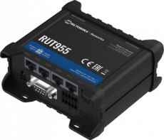
<td>[[File:Rut955_hd_4_demo.png|link=Special:Redirect/file/Rut955_hd_4_demo.png|center|230px|RUT955]]</td> | |||
</tr> | |||
<tr> | |||
<td style="text-align: center;"><b>RUT955</b></td> | |||
| | </tr> | ||
<tr> | |||
<td> | |||
<table> | |||
<tr> | |||
<td>[[File:Rut955 hd 4 demo.png|link=Special:Redirect/file/Rut955_hd_4.png|center|35px]]</td> | |||
<td>[[File:Rut955 hd 5 demo.png|link=Special:Redirect/file/Rut955_hd_5.png|center|31px]]</td> | |||
<td>[[File:Rut955 hd 9 demo.png|link=Special:Redirect/file/Rut955_hd_9.png|center|26px]]</td> | |||
<td>[[File:Rut955 hd 10 demo.png|link=Special:Redirect/file/Rut955_hd_10.png|center|52px]]</td> | |||
<td>[[File:Rut955 hd 6 demo.png|link=Special:Redirect/file/Rut955_hd_6.png|center|45px]]</td> | |||
</tr> | |||
</table> | |||
</td> | |||
</tr> | |||
</table> | |||
</font> | </font> | ||
A '''satellite navigation''' or '''satnav''' system is a system that uses satellites to provide autonomous geo-spatial positioning. A satellite navigation system with global coverage may be termed a '''global navigation satellite system''' ('''GNSS'''). Read on below to find out how one customer uses Teltonika's RUT routers as their communication solution with high precision GNSS antennas. | A '''satellite navigation''' or '''satnav''' system is a system that uses satellites to provide autonomous geo-spatial positioning. A satellite navigation system with global coverage may be termed a '''global navigation satellite system''' ('''GNSS'''). Read on below to find out how one customer uses Teltonika's RUT routers as their communication solution with high precision GNSS antennas. | ||
| Line 42: | Line 49: | ||
==External links== | ==External links== | ||
<ul> | |||
<li>[https://teltonika-networks.com/product/rut955/ RUT955 homepage]</li> | |||
</ul> | |||
[[Category:RUT955 Success Stories]] | [[Category:RUT955 Success Stories]] | ||
Revision as of 08:57, 8 March 2019
Main Page > EOL Products > RUT955 > RUT955 Usage Scenarios > RUT955 Success Stories > RUT955 with GNSS antennas
 |
|||||
| RUT955 | |||||
|
|
A satellite navigation or satnav system is a system that uses satellites to provide autonomous geo-spatial positioning. A satellite navigation system with global coverage may be termed a global navigation satellite system (GNSS). Read on below to find out how one customer uses Teltonika's RUT routers as their communication solution with high precision GNSS antennas.
Summary
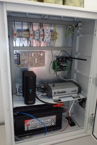
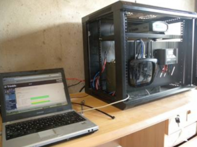
A customer uses RUT955 routers for remote communication with high precision GNSS antennas, storing data to an SD card when data connection is down and sending data to a remote server when the connection is up, for which they use a set of scripts developed by themselves.
Challenge
Finding a router with reliable remote communication capabilities, customizable firmware and network storage capabilities.
Solution
The solution couldn't be simpler with Teltonika's RUT955 routers in hand as they match all of the customer's requirements, including extensive customization capabilities, a flexible build environment and micro SD card support.
Attachments
 |
 |
Benefits
RUT955 routers provide mission-critical cellular communication capabilities which is imperative for the customer's needs. Furthermore, RUT routers use RutOS - an operating system (OS) powered by Linux based on OpenWRT, and it has GPL package with a build environment provided, making software customization and in turn the incorporation into other systems easy.


