Vehicle height laser detection system
Transport for Cape Town (TCT) recently installed a 3D laser detection system in Muizenberg to prevent vehicles with a height of over 2.5m from crashing into the low railway bridge at Atlantic Road.
|
|
Summary
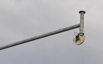
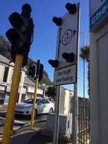
The laser scans both lanes all day, while the system controller determines whether a detected vehicle is over the stipulated height. If the system determines that the over-height vehicle is in the turning lane or straddling both lanes, it triggers the LED flasher. If a vehicle is over the admitted height but not in the turning lane, the system records the event but does not trigger the LED system. The LED flasher will flash for a configurable amount of time, typically 40 seconds. The system can also be remotely monitored at the Transport Management Centre.
Customer profile
Transport for Cape Town (TCT)
Challenge
The railway bridge crossing Atlantic Road in Muizenberg is notorious for crashes, because road users underestimate the height of their vehicles or load,” said Cape Town Councilor Brett Herron. Herron said a warning system was required to improve the safety of road users and to prevent crashes into the bridge. TCT officials proposed a 3D laser detection system – a first for Cape Town – following international research.
Solution
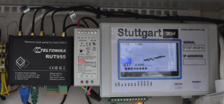
The specifications for the laser system were drawn up by TCT. The system software was developed by local company Radar Vision, which sourced the laser from Europe. The sensor is a Class 1 laser device that emits infrared light invisible to humans and has an operating temperature range of -10C to 70C. The system scans the roadway 50 times per second, taking a measurement every 0.5 degrees. The sensor reports distance in millimetres for each measurement. The road is 6,600mm vertically below the sensor, while traffic with a height above 500mm from the road surface is recognised. The sensor measures vehicles up to 5.8m in height, and 8.5m of the road’s width. The system controller does all the calculations to determine which lane every detected point is in. The controller runs an operating system with support for remote monitoring and configuration. The controller has a graphical touchscreen display and logs all traffic heights to flash storage. The real-time display provides local and remote vehicle-by-vehicle height display.
Attachments
Benefits
A great success so far. Although it is too early to determine the success of the new system, it is noteworthy that no crashes have occurred since it started operating on 1 June.


